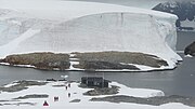
Gaunt Rocks
The Gaunt Rocks are a small group of rocks lying 2 nautical miles (4 km) west of the Barros Rocks, in the Wilhelm Archipelago. They were roughly charted by the British Graham Land Expedition under John Rymill, 1934–37, and more accurately positioned by the Falkland Islands Dependencies Survey from photos taken by Hunting Aerosurveys Ltd in 1956–57. The name, given by the UK Antarctic Place-Names Committee in 1959, is descriptive of these desolate, grim-looking rocks.
Read article
Top Questions
AI generatedMore questions
Nearby Places

Galindez Island
Antarctic island

Argentine Islands
Group of islands in Wilhelm Archipelago
Winter Island (Antarctica)
Island in Wilhelm Archipelago, Antarctica
Ambrose Rocks
Cluster of rocks off Graham Land, Antarctica
Urchin Rock
Whiting Rocks
Frost Rocks
Skua Island (Antarctica)
Island in Wilhelm Archipelago, Antarctica